District Maps
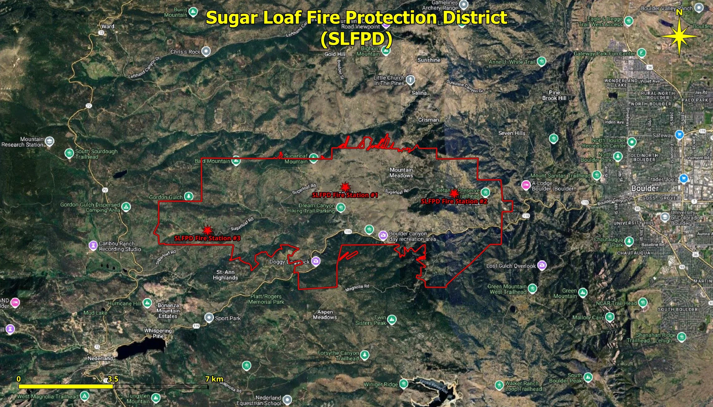
Map # 1 - SLFPD Boundary (red line) and Fire Stations (red stars) on Google Satellite Imagery
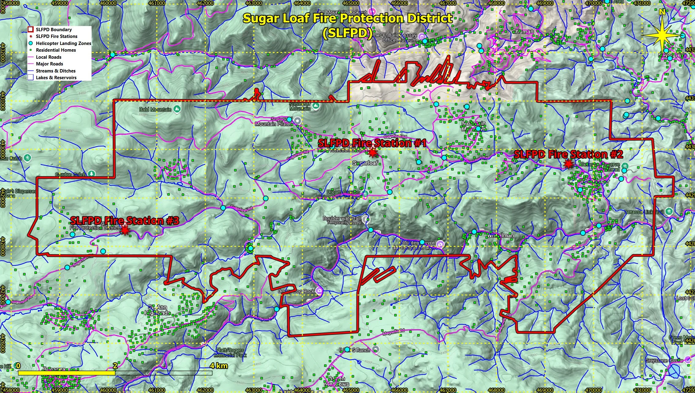
Map # 2 - SLFPD Boundary + Fire Stations and GIS vector data on Google Terrain Hybrid Map
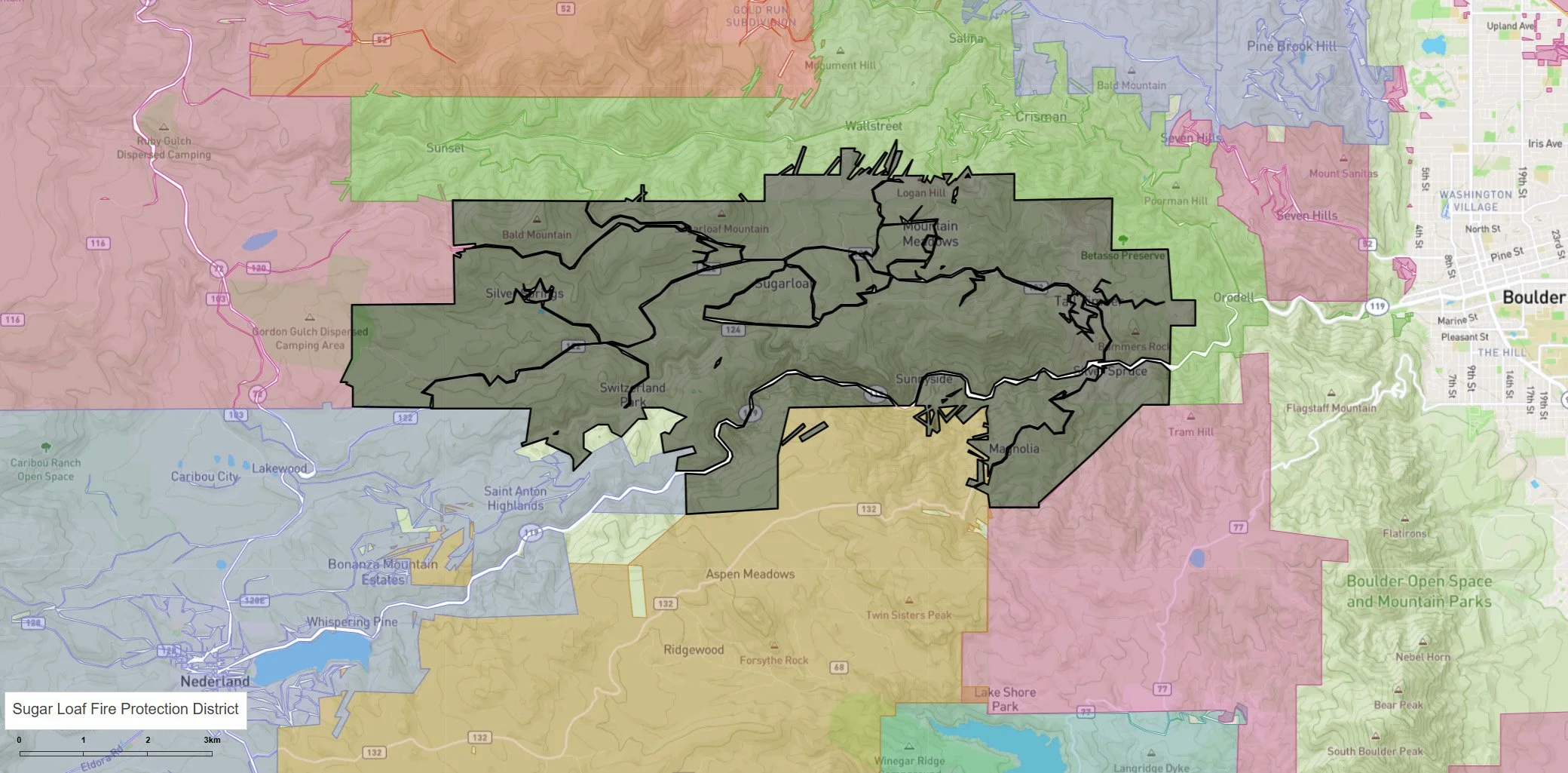
Map # 3 - SLFPD Boundary and Major Roads from the Colorado Department of Local Affairs (DOLA) Website